| Jewiki unterstützen. Jewiki, die größte Online-Enzyklopädie zum Judentum.
Helfen Sie Jewiki mit einer kleinen oder auch größeren Spende. Einmalig oder regelmäßig, damit die Zukunft von Jewiki gesichert bleibt ... Vielen Dank für Ihr Engagement! (→ Spendenkonten) |
How to read Jewiki in your desired language · Comment lire Jewiki dans votre langue préférée · Cómo leer Jewiki en su idioma preferido · בשפה הרצויה Jewiki כיצד לקרוא · Как читать Jewiki на предпочитаемом вами языке · كيف تقرأ Jewiki باللغة التي تريدها · Como ler o Jewiki na sua língua preferida |
Datei:British Isles Ireland higlighted.svg
Zur Navigation springen
Zur Suche springen


Größe der PNG-Vorschau dieser SVG-Datei: 343 × 600 Pixel. Weitere Auflösungen: 137 × 240 Pixel | 274 × 480 Pixel | 439 × 768 Pixel | 586 × 1.024 Pixel | 675 × 1.180 Pixel.
Originaldatei (SVG-Datei, Basisgröße: 675 × 1.180 Pixel, Dateigröße: 53 KB)
Beschreibung
| Beschreibung |
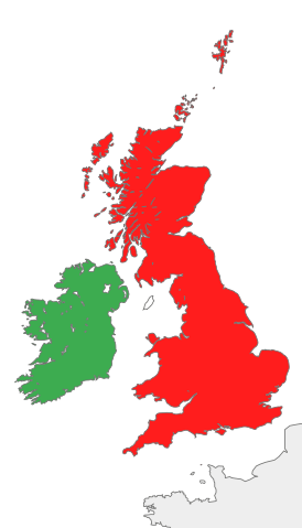
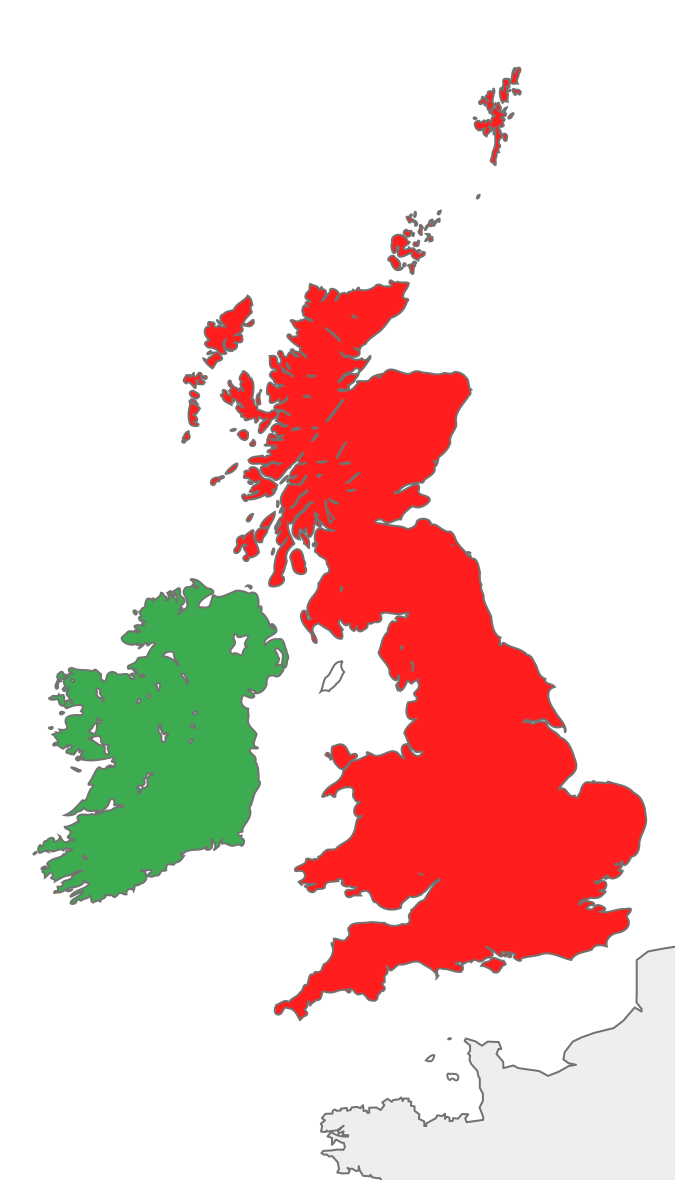
Deutsch: Karte des Vereinigten Königreichs von Großbritannien und Irland mit Markierung Irlands.
English: Map of the island of Ireland and the island of Great Britain, with green Ireland in green color. |
||
| Datum | |||
| Quelle |
Diese Datei wurde von diesem Werk abgeleitet: British Isles all.svg: |
||
| Urheber | Furfur | ||
| SVG‑Erstellung |
|
Lizenz
Ich, der Urheber dieses Werkes, veröffentliche es unter der folgenden Lizenz:
| Ich, der Urheberrechtsinhaber dieses Werkes, veröffentliche es als gemeinfrei. Dies gilt weltweit. In manchen Staaten könnte dies rechtlich nicht möglich sein. Sofern dies der Fall ist: Ich gewähre jedem das bedingungslose Recht, dieses Werk für jedweden Zweck zu nutzen, es sei denn, Bedingungen sind gesetzlich erforderlich. |
Ursprüngliches Datei-Logbuch
This image is a derivative work of the following images:
- British Isles all.svg licensed with PD-self
- 2012-09-14T08:21:12Z Palosirkka 675x1180 (55591 Bytes) Scrubbed with http://codedread.com/scour/
- 2007-10-20T18:30:43Z Cnbrb 675x1180 (139477 Bytes) == Summary == {{Information |Description=map of Great Britain and Ireland, also known collectively as the British Isles, or the Islands of the North Atlantic |Source=self-made |Date=2007-20-09 |Author= [[User:Cnbrb|Cnbrb]] }}
- 2007-10-20T18:28:26Z Cnbrb 675x1180 (139477 Bytes) == Summary == {{Information |Description=map of Great Britain and Ireland, also known collectively as the British Isles, or the Islands of the North Atlantic |Source=self-made |Date=2007-20-09 |Author= [[User:Cnbrb|Cnbrb]] }}
- 2007-10-20T18:27:20Z Cnbrb 675x1180 (139477 Bytes) == Summary == {{Information |Description=map of Great Britain and Ireland, also known collectively as the British Isles, or the Islands of the North Atlantic |Source=self-made |Date=2007-20-09 |Author= [[User:Cnbrb|Cnbrb]] }}
- 2007-10-20T18:26:33Z Cnbrb 675x1180 (139477 Bytes) == Summary == {{Information |Description=map of Great Britain and Ireland, also known collectively as the British Isles, or the Islands of the North Atlantic |Source=self-made |Date=2007-20-09 |Author= [[User:Cnbrb|Cnbrb]] }}
- 2007-10-20T18:14:52Z Cnbrb 675x1180 (317766 Bytes) == Summary == {{Information |Description=map of Great Britain and Ireland, also known collectively as the British Isles, or the Islands of the North Atlantic |Source=self-made |Date=2007-10-09 |Author= [[User:Cnbrb|Cnbrb]] }}
- 2007-10-20T18:10:39Z Cnbrb 675x1180 (633628 Bytes) == Summary == {{Information |Description=map of Great Britain and Ireland, also known collectively as the British Isles, or the Islands of the North Atlantic |Source=self-made |Date=2007-10-09 |Author= [[User:Cnbrb|Cnbrb]] }}
- 2007-10-20T18:08:30Z Cnbrb 675x1180 (632324 Bytes) == Summary == {{Information |Description=map of Great Britain and Ireland, also known collectively as the British Isles, or the Islands of the North Atlantic |Source=self-made |Date=2007-10-09 |Author= [[User:Cnbrb|Cnbrb]] }}
- 2007-10-20T18:04:37Z Cnbrb 675x1180 (632324 Bytes) == Summary == {{Information |Description=map of Great Britain and Ireland, also known collectively as the British Isles, or the Islands of the North Atlantic |Source=self-made |Date=2007-10-09 |Author= [[User:Cnbrb|Cnbrb]] }}
Hochgeladen mit derivativeFX
Dateiversionen
Klicke auf einen Zeitpunkt, um diese Version zu laden.
| Version vom | Vorschaubild | Maße | Benutzer | Kommentar | |
|---|---|---|---|---|---|
| aktuell | 21:32, 13. Feb. 2018 | | 675 × 1.180 (53 KB) | Geralt Riv | optimization |
Dateiverwendung
Die folgende Seite verwendet diese Datei: